 MICHAEL
 · Data enhancement
Make agency data ready for analysis.
Addresses with no coordinates, a date column the software has to be told about, no field anywhere for hour of day, and a ZIP code that some tool will average if you let it. This is the view that fixes all of it before you start, and it works out most of it on its own.
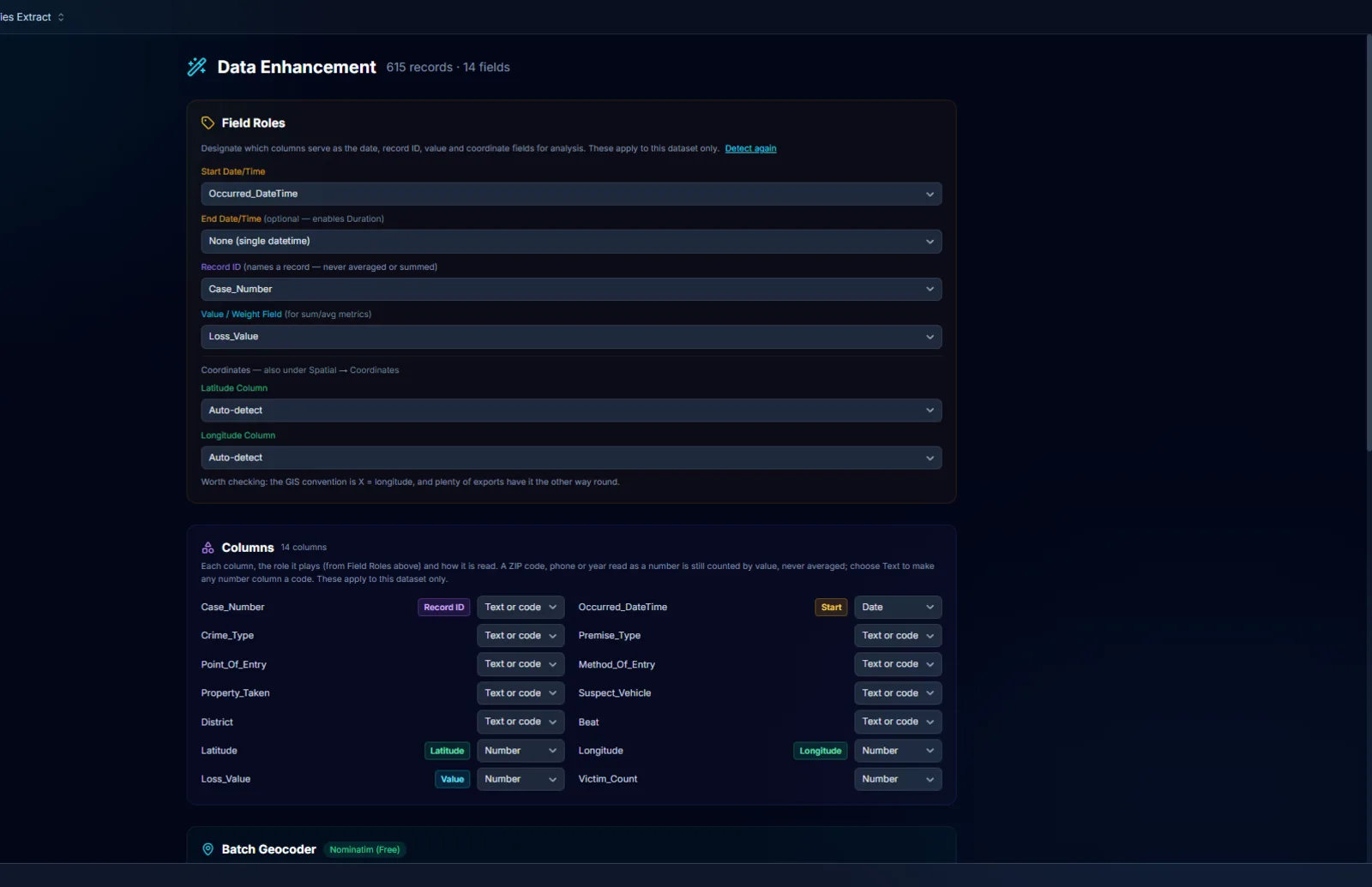
Tell it once which column is which, and every view follows.
The start date, the end date, the record ID, the value, the coordinates. Detected when the file opens, set by hand when the detection is wrong, and applied to this dataset only.
- 01Field roles. Start and end date, record ID, value or weight, latitude and longitude, and a second place in the same row: where a stolen vehicle was recovered, an offender's home, a unit's arrival. The end role is what unlocks the window methods in Time Span Analysis. Detect again when a file changes.
- 02Column types, checked before they change. Text or code, Number, Date. A column becomes a number or a date only when nearly all its values read that way. A ZIP code, phone number, beat, case number or year stored as a number is counted by value and never averaged, and a year is written as a year, 1972, never 1,972.
- 03Coordinates the way records systems actually store them. State Plane or UTM X and Y are recognized and the likeliest system offered first, with latitude and longitude added while the originals stay as they were. A record at exactly 0, 0, which is what a failed geocode writes, is kept off the map and offered to the geocoder.
- 04Date in one column, time in another. A file that writes them apart used to import with every record at midnight. MICHAEL joins them and says so.
Each address is looked up once and remembered.
Addresses in, latitude and longitude out, with a confidence rating written back beside every hit. Records that already have coordinates are skipped, and what has been found before is never sent again.
- 01Free, or with your own key. OpenStreetMap's Nominatim is free, needs no key, and is a volunteer-run service limited to one request a second, so MICHAEL caps a free run at 50 addresses and refuses a larger one outright rather than quietly hammering it. A real batch needs a Google key, and the panel says so before it starts, in records and minutes rather than in a usage policy nobody reads.
- 02The Address book. Before anything is sent, MICHAEL checks every address against the book and against the records that already have a location, counting 100 Main Street and 100 MAIN ST as one. Only what neither knows is looked up, each address once however many records share it. Every address found joins the book, a dataset in your list like any other.
- 03Your corrections win. Open the Address book and correct a location by editing the cell; the geocoder uses your correction from then on. The next export updates locations from your earlier file and replaces any geocoder's answer, but never a location you corrected by hand.
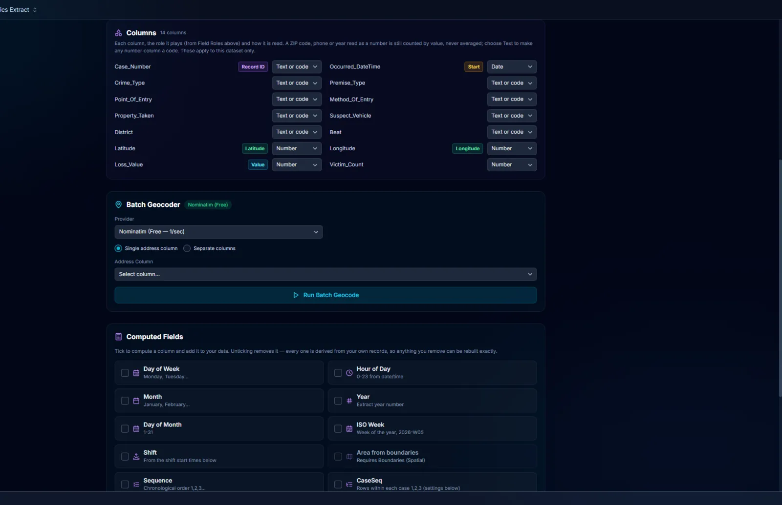
Seventeen computed fields, a tickbox each.
The columns you would otherwise build by hand every time you start a case. Each becomes a real column you can sort, chart, map and export, and a field that cannot be computed yet says what it is waiting for.
- 01Time. Day of week, hour of day, month, year, day of month, ISO week written as 2026-W05 so it sorts, and shift from your own shift start times, 06:00, 14:00 and 22:00 by default.
- 02Order and rhythm. Sequence, the T coordinate in cumulative hours from the first event, inter-event time in days, inter-event distance in miles read the way the map reads coordinates, and duration from start to end. The first record, which has no previous one, is left blank rather than 0.
- 03Place. Area from boundaries names the beat, district or precinct each record falls in from the boundaries loaded in Spatial; records outside every area say Outside, records without coordinates stay blank, and both are counted. Miles, direction and days to recovery come from the second place.
- 04One row per case, with every record kept. Exports taken by offense, person or vehicle repeat a case on every row, so counts count offenses. CaseSeq numbers the rows within each case, most serious offense first, and Keep the 1s shows one row per case in every view.
- 05Seventeen fields, one tickbox each. Untick a field and its column goes, which is safe because every one is derived from your own records and can be rebuilt exactly. Unticking can never reach an imported column or a geocoded coordinate.
Fix the data where you found it, and keep the receipt.
A wrong value in the grid, a dot in the wrong place on the map, a file that needs today's records added. Each is a correction you can see, undo, export and, when you choose, write back.
- 01Edit a cell, or move a dot. Double-click a cell or open the record and press Edit. On the map, right-click a dot to open its record, or press Move this point and click where the incident really happened. Edited cells are marked in amber, Ctrl+Z undoes the latest, and a computed column cannot be typed over.
- 02The receipt. Show edited records narrows every view to them, and Export edits saves every change, the record, the column, the old value, the new value and when, as a CSV. Edits are kept with the dataset and put back after a refresh, matched by case number; where the source itself changed that value since, the source wins and the message says how many.
- 03Save to the file, when you say so. For a CSV, Excel or Access file, edits stay in MICHAEL until you press Save to that file, every change is listed first, and a copy of the file as it was is kept beside it. A link, API or database is never written to.
- 04Today's file, into the dataset you keep. Import a file with the same columns and add its records: a row already held is skipped and counted. Replace a dataset with a newer copy and it keeps its enhance columns, roles, logged series and edits.
- 05Out again, intact. Export the grid as you see it to CSV, an Excel workbook or an Access database. Dates arrive as dates, codes keep their leading zeros, and blanks stay blank.
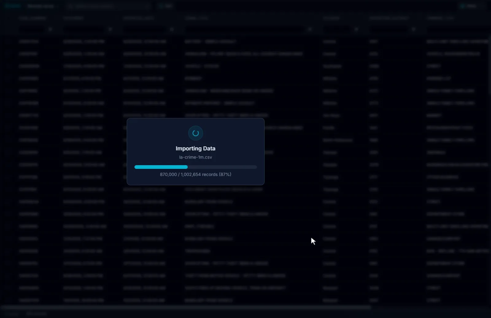
It prepares the data and tells you exactly what it did.
Every shortcut on this page has a place where it stops and tells you, because a column that looks complete and is not is worse than an empty one.
- 01A geocode carries its confidence. Every hit is written back with a rating, a failed one is marked failed, and a record at 0, 0 is kept off the map and named rather than drawn in the ocean. The map is only as right as the addresses were.
- 02A computed field waits for its inputs. Duration needs an end date, days to recovery needs a second place, area needs boundaries. A field that cannot be computed yet says what it is waiting for instead of filling with zeros.
- 03The source file changes only when you press Save, and then only the cells you changed, with the file as it was kept beside it. A file open in Excel or Access, or saved by another program since you imported it, is not written into, and MICHAEL says why.
- 04Only addresses the geocoder has never seen are sent, and only to the provider you chose. Which provider, how many addresses, and how long it will take are on the panel before the first request goes out.
Try it on your own data.
Fourteen days, every feature, on one machine. Tell us who you are and we will email you your own download link. Nothing to activate. Your data stays on your machine and stays yours when the trial ends. No newsletter, no drip sequence.
Built for the people who do the work Sworn agencies, crime analysis units, public safety partners, and corporate investigation teams. Workstations are $2,500 a year, everything included. Academia and nonprofits: ask about license pricing.
Or email info@sworn.ai. A person answers.